In almost a week, I will be on a plane to Peru! My friends and I are doing the Salkantay Trek to Machu Picchu (a hardcore, off-the-beaten-path alternative to the Inca Trail). The scenery will be spectacular, the sites rich with cultural history…and of course, Machu Picchu is considered one of the seven wonders of the world. Needless to say, I’m psyched.
When I was first invited on this trip to Machu Picchu, however, my friend failed to mention some of the more extreme aspects of the trek. But once I agreed to the trip and the planning began, some concerning information came to light. For starters, there are no bathrooms on the Salkantay Trek, while there is at least one along the Inca Trail – for four days and three nights, when you need to relieve yourself for #1 or #2, we can literally say “nature calls” because there is nowhere else to go. At the end of each day’s arduous hike, a mere bowl of water will be provided each night to wash ourselves. We will be hiking for four days, and camping three nights, in high elevations that could cause altitude sickness. We will be carrying heavy backpacks that contain any supplies we may need for the day’s hike. Ahhhh!
I’d like to think of myself as an outdoorsy person. I mean, I truly do appreciate the beauty of nature and enjoy being outside. I’ve been on a few camping trips…but there was usually a bathroom or port-a-potty nearby. I’ve been hiking…about once a month for one to two hours, usually with nice views of – the city, and no backpack to weigh me down.
But this trek…this is a llama of a different color. I started freaking out once I realized what I signed up for. Then I stopped freaking out and started preparing. I raided my local REI, started taking iron and ginko baloba supplements to prepare my blood for the high altitude, joined a Meetup group for hiking (in addition to doing hikes with friends and family), and started carrying a backpack. I thought I’d share some of the more beautiful interesting hikes with y’all.
Bridge to Nowhere
The Bridge to Nowhere hike is a beautiful, dynamic, and lengthy hike located in the Azusa area. Clocking in at 10 miles, roundtrip, it begins with some delightful river action. My balance skills were tested as we stepped on precarious stones and logs to cross the river at multiple junctures (My skills failed…I had to rely on my trekking pole to keep me out of the water. Although falling into cool, shallow river currents wouldn’t be the worst thing in the world on a hot summer’s day).
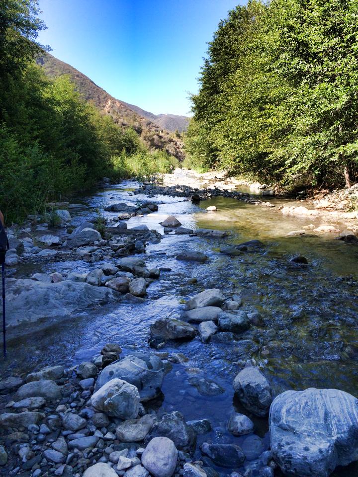
After hiking along the shady, peaceful river path, the terrain suddenly changed into a dry but beautiful desert-like area filled with towering spears of strange flowers. This part was hot, to be sure…but there was always something interesting to look at. Beware of the spiky bushes, though! They hurt!

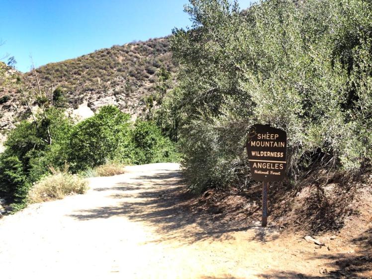
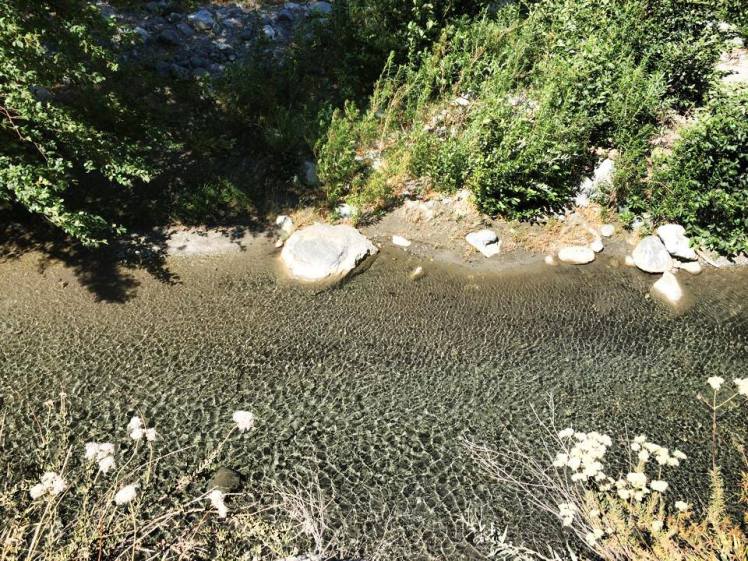
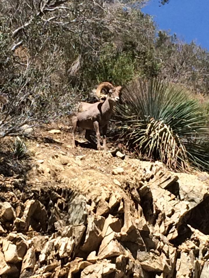
The terrain shifted yet again at the Sheep Mountain Wilderness are. The going got tougher as we hiked up the mountain a bit on a dry, dusty path that was at times slippery. But we were rewarded with some nice views of the river below us, although in many spots the riverbeds had run dry. And there is always the possibility of catching a glimpse of some mountain sheep. We got lucky and were rewarded with a view of a bold ram on a higher ledge of the mountain, surveying us like an apathetic god.
The final stretch to the bridge was a killer. We were high above the river, beaten down by the sun, scavenging for pockets of shade. Although we were hungry, we wanted to wait to reach the bridge to enjoy lunch down at the river. But when the Bridge to Nowhere finally came into view, relief washed over us like…a river? Haha, too easy. Anyway, there were people jumping off of the bridge. And I don’t mean they were suicidal…they were bungee jumping! (Though some people think bungee jumpers are suicidal).
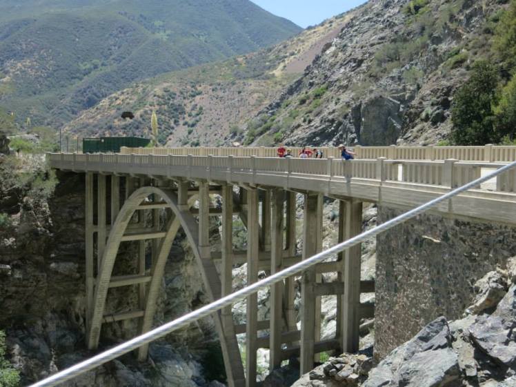
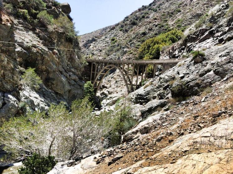
We watched the jumpers with horror for a while…they kept bouncing around on their cords, and I kept fearing that they would crack their skull on one of the bridge’s pillars. Finally, our stomachs got the better of us. We crossed the bridge, which does indeed lead nowhere. To be more precise, it hits a mountain…but there was a little trail that led down that mountain to the beginning (or end?) of the river, where the water pooled into certain areas that then spilled down into other pools. Tons of people were swimming and frolicking in the water, and plenty others found a niche in the surrounding rock walls and were eating their lunches. We followed suit. We came, we saw, we conquered. We ate, frolicked, we napped. And then it was time to head back.


The hike back felt brutal to me. The afternoon sun was at its peak, and my poor feet were weak and weary. But as difficult as it was, the Bridge to Nowhere hike is so interesting that it remains one of my favorite hikes.
Mt. Baldy
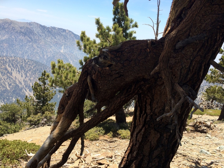
At 10,000 ft. elevation, Mt. Baldy was a toughie. I endured a lot of difficult uphill hiking, with many mini-breaks along the way. But it still felt amazing to be up so high, with lovely foresty trees waving you onward and upward. The very top, however, was treeless (hence Mt. Baldy). There were some nice white patches of snow, though. It felt amazing to cool my hot, swollen hands with a summer snowball. And I enjoyed a sense of accomplishment to reach the peak…started from the bottom, now we’re here!


Cave of Munits and Castle Peak
I live in the vast wasteland known as the Valley (the San Fernando Valley, if you want to get technical). Yes, I am a Valley Girl (like, totally). But although I’ve lived in or near the valley for much of my life, until recently I was woefully unaware of the variety of gorgeous hikes that were a mere hop, skip, and jump away. Sure, I’d been on some plain mountain trails in the Valley. But I never knew there were caves…and places where I could channel my inner rock climber as I hoisted myself up craggy rockfaces.


The Cave of Munits is pretty frickin’ cool…except that some annoying Valley teens thought the same thing. The cave is marked with a bit o’ graffitti and littered with a sprinkling of candy wrappers and cigarette butts. But it’s still awesome.

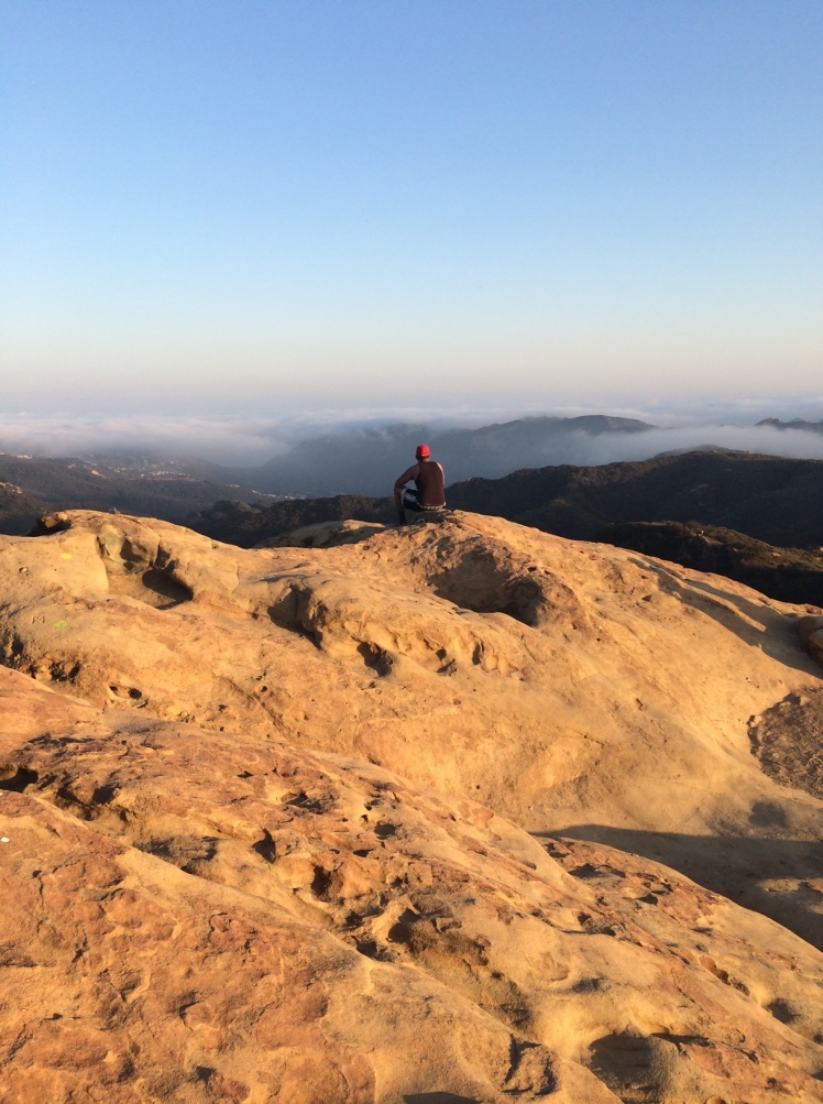
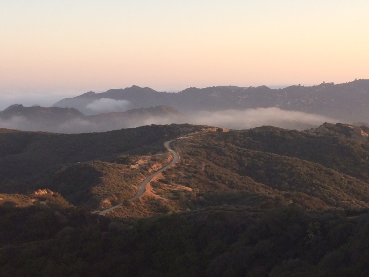
Castle Peak, which is a lookout point above the cave and down a ways, offers a great view of the Valley.


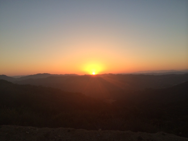
And if you hike down the hill at sunset….foggettaboutit. Gorgeousness.


Eagle Rock
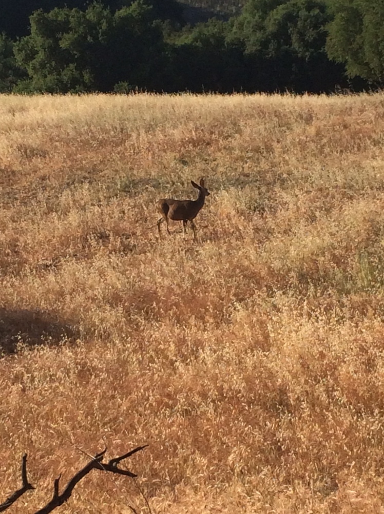
My brother exposed me to yet another Valley gem. Burrowed within the Topanga Canyon pass are small roads that lead up to various trailheads. Once such trailhead leads to Eagle Rock. The trail itself is fairly simple; it’s basically a fireroad that goes uphill. But as simple as it may seem, this hike still offered many little pleasures. For example, some deer grazing in the fields nearby!
And once you reach Eagle Rock, you can survey the lands below like a queen observing her kingdom from the castle tower. Eagle Rock itself is pretty epic…it calls to mind Pride Rock from The Lion King.

The sunsets are also quite lovely!
Charmlee Wilderness Park
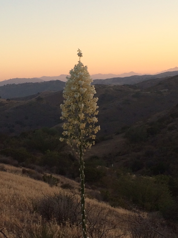
The drive to Charmlee Wilderness Park is a splendor in itself. It is a beautiful and relaxing drive, especially as you pass the vineyards adorning the mountainsides. The park has many good options for trails, and there are some nice wildflowers sprinkled about, although there is probably an even more colorful profusion in the springtime. And I took a liking to the grand, sprawling trees whose leaves bowed down to create a sheltered circle of absolute shade, like a self-contained tent; I of course was compelled to climb one of these trees.
But my favorite thing about this hike is the spectacular ocean view. For most of our hike, we were accompanied by views of the deep blue sea, twinkling and beckoning to us as we sweated above it in the unforgiving sun. There was a path that did actually go down to Pacific Coast Highway, but tempting though it was, we did not dare venture it…for then we would have to climb all the way back up. We settled for driving home and jumping in the pool instead, which wasn’t a bad alternative!

Well, Peru is coming up in almost a week! I probably won’t have time for another big hike, what with all the packing and last-minute shopping and full-time freaking out. But perhaps I will sneak in at least one short local hike.
Update: Check out my account of my crazy trip to Peru, starting at Adventure and Disaster in Peru – Day 1

Very similar to your experience, I signed up for a trip in India that I just recently found out will be taking me to 13,000 trekking! I have a little over a month to prep for high altitude. Can you please share which MeetUp group or groups you joined and liked? Also, how did you find out about iron and ginko doses to prep?
Thank you so much!
Hi there! I’m not sure what area you live in, but I joined Calabasas Day Hikers. I started with easier hikes and worked my way up to longer, higher-elevation full-day hikes like Mt. Baldy. I’m sure there are plenty of other hiking groups on MeetUp as well. I just took the daily recommended does of iron/ginko. My friend also bought altitude pills for the trip. The best bet is, when arriving to the high-elevation area in India, to be able to spend some days acclimating to the higher altitude before you begin hiking. Hope you have a blast!! 🙂